
Every day, we hear how AI is changing the ways we learn, work, and live.
At the College of Engineering & Computing, we are focused on transforming the potential of AI into discoveries, innovations, and products that improve lives. Predicting environmental processes is one area where AI power can be harnessed.
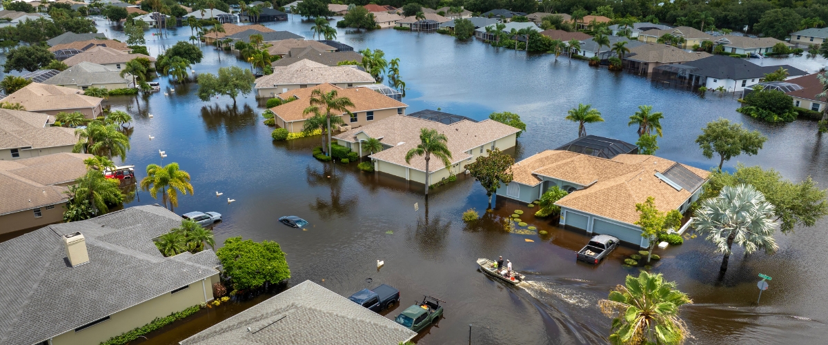
Hurricane season in the North Atlantic is peaking with millions of people around the U.S. potentially in harm’s way. Early warnings of hurricane-force conditions can help officials plan evacuation routes, protect property, and save lives.
Flooding is among the most dangerous and destructive impacts of a hurricane. At FIU, we are researching how AI and machine learning can be used to predict flood locations and timing faster and more accurately. I want to provide you an example of this type of work.
Flood forecasting capabilities have greatly improved over the years. However, the work of Dr. Navid Tahvildari, an associate professor in the Department of Civil & Environmental Engineering, shows there is more potential to unlock. He studies how machine learning can speed up flood prediction without sacrificing accuracy.
It is important to consider typical flood forecasting approaches to understand the innovation behind Tahvildari’s research.

He started by researching how AI can be used to create accurate rapid forecasts of water levels along the coastline. At his previous institution, Tahvildari and his student, Ali Shahabi, built a machine-learning model that predicts coastal water levels across the Chesapeake Bay using wind data and tide records. The model ran in a fraction of a second, compared with the hours a physics-based model would typically take to calculate water levels across a similarly sized region. The AI model performed well for nine hurricane simulations when compared to a physics-based model used by the Army Corps of Engineers. Their findings were published in Coastal Engineering.
At FIU, Tahvildari and Shahabi expanded this model to the coastlines of the continental U.S. Their recent work shows that the deep learning model performs better or is comparable to NOAA’s physics-based operational models in minor and moderate flooding conditions across the U.S. coastlines. Accuracy of the model suffers in rare extreme events where training data is scarce, but the team plans to overcome this shortcoming by augmenting the training data with synthetic extreme events.

Figure 1. A deep learning model for coastal water level prediction outperforms NOAA’s operational forecast at various locations along U.S. coastlines. Green dots indicate gauge locations where the AI model outperforms the operational forecast model at one example instant and orange dots show the ones where the opposite is true. This comparison is updated in real-time and can be used in flood advisories and preparations for emergency operations (from Shahabi and Tahvildari, manuscript in review in Nature Communications).
The long-term goal, Tahvildari says, is bringing similar speed to street-level urban compound flooding where rainfall and storm tides both contribute to flooding substantially. It is key to account for the operation of flood management features like stormwater infrastructure, he adds.

“AI models work differently. They learn from an abundance of historic and synthetic data on water levels, weather, even flood camera images, the same way that a large language model draws on everything it has learned.”
Faster models could give emergency planners sufficient time ahead of the storm and also enable them to test "what if" scenarios as storm conditions evolve in real time. For example, in 2019, Hurricane Dorian approached Florida as South Florida was experiencing a king tide, raising concerns about the combined effects of the storm and unusually high tides. Dorian ultimately stayed offshore, but if something similar were to happen in the future, fast, comprehensive forecasts could help emergency managers understand how these conditions might interact in real time. Such models also provide benefits in long-term planning by lowering the computational burden of testing a variety of flood mitigation solutions.
Tahvildari has turned to a variable that most models fail to integrate with storm surge hydrodynamic models: urban stormwater drainage systems.
"Many models can simulate how stormwater propagates over land, but accurate simulation of what happens to it once it is there needs incorporation of additional models, which is seldom pursued. The models we are working on couple the surge model with the drainage network, so we can see how long water will realistically remain in an area. This work is vital for highly urbanized areas like South Florida, which are at a high risk of storm surge and intense rainfall. Coupled hydrodynamic-pipe hydraulic models also enable incorporation of features like channels and gates, which are important components of the water management system in South Florida,” Tahvildari says.

Figure 2. A deep learning model trained by data from the physics-based hydrodynamic+pipeline hydraulics model for compound flooding provides results comparable to the physics-based model (outside the area of training data) but expedites the computation by 700 times (from Shahabi and Tahvildari, Coastal and Estuarine Research Federation Biennial Conference, 2025).
Tahvildari is contributing his expertise in hydrodynamic and AI flood modeling to NASA’s Coastal Zone Digital Twin program, an initiative to create a digital replica of interconnected coastal systems across the U.S. with an AI framework to help emergency managers and resource planners make informed decisions.
Meanwhile, his knowledge will matter greatly as we launch one of the most ambitious projects in FIU history.
The Extreme Storm Simulator (ExtremeS) is a facility that will change how we study hurricanes. With a design supported by funding from the NSF, ExtremeS (formerly “NICHE”) will be the largest testbed in the world for studying wind, storm surge, and waves acting together on natural and built full-scale infrastructure.

World's largest full-scale wind-wave-surge testbed (when built).
Right now, researchers and policymakers have limited ability to test how infrastructure behaves under real hurricane conditions. ExtremeS provides an opportunity to do that for the first time.
An undertaking like this takes a multidisciplinary group of experts. In the preliminary design phase of the ExtremeS project, Tahvildari’s team is simulating the overland flow process generated by a current circulation system using computational fluid dynamics (CFD). The capability to generate overland flow will enable ExtremeS to simulate the realistic storm surge inundation process. The CFD simulations of the process enabled preliminary evaluation of currents in the facility and its potential impacts on waves, and testing the performance of different setups for the pump and pipe system.
It is exciting for FIU’s College of Engineering & Computing to be leading “moonshot” research that will transform understanding of hurricane impact on coastal communities. Tahvildari’s work is another example of our College’s focus on knowledge creation, discovery, innovation, and ultimately societal benefit. I look forward to sharing with you what we learn along the way.